What shall be considered before purchasing a mapping drone?
1. Easy operation
2. Automated control
3. Output quality
4. Survey-grade demand
5. Cost efficiency
6. Responsive support
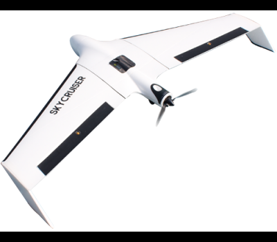
1. UAV = 25000$
2. Sony ILCE-QX1 = 2500$
3. 6Days Training = 4500$
---------------------------------------
32000$
A professional-level drone made for survey-grade mapping applications...
1. Simple assembly and quick hand launch
2. Humanized GCS software with interactive interfaces
3. Excellent flight attitude due to moderate drone weight
4. Quality imageries to generate survey-grade outputs
5. Reasonable costs versus high work efficiency
6. Trusted local dealer and renowned survey manufacturer standby
Mission Planning Simplicity
Low-battery Auto Return
Multi-zone Mission Planning
Large Area Photogrammetry
Terrain Condition Evaluation
GCS Power-off Protection
Compulsory Checklist Reminder
One-key Return Home
All-in-one GCS Processing
Aborting Landing Contingency
Extraordinary Interaction Experience
.png)
.png)
.png)


